Before GPS Knew Where You Were Going: The Lost Art of American Navigation
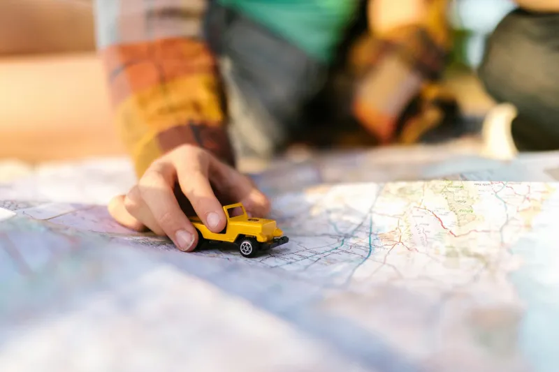
The Ritual of the Road Atlas
Every spring, American families would perform the same ritual. Dad would walk into the AAA office and emerge with a fresh road atlas, its spine still uncracked, pages crisp with possibility. The old one would be relegated to the glove compartment as backup, its corners worn soft from a year of consultation at gas stations and rest stops.
This wasn't just a book of roads—it was a passport to adventure, uncertainty, and the kind of genuine discovery that's nearly impossible today.
In 1985, if you wanted to drive from Chicago to your cousin's wedding in Nashville, you'd spread that atlas across the kitchen table the night before. You'd trace your finger along the interstate highways, marking the route with a highlighter. Your mom might call her sister to double-check the exit number, writing it on a scrap of paper that would live on the dashboard for the entire trip.
Getting lost wasn't a failure—it was an expected part of the journey.
When Gas Stations Were Navigation Centers
Pull into any Texaco or Shell station in 1990, and the attendant behind the counter was part mechanic, part local historian, part GPS unit. These weren't minimum-wage teenagers scrolling through phones. They were usually locals who'd lived in the area for decades, who knew that the bridge on Highway 34 was out for construction, or that you'd want to avoid downtown during the lunch rush.
"You're looking for the Morrison place? Oh, you'll want to go past the old grain elevator—can't miss it—then turn left at the church with the red door."
These directions came with landmarks that actually meant something to the people who lived there. The grain elevator, the church, the bend in the river where the road curves—these were navigation points that connected you to the landscape in a way that "turn right in 500 feet" never could.
Today, gas stations are convenience stores with fuel pumps. The person behind the counter might not even live in the same county, let alone know where the Morrison place is.
The Art of Reading the Land
Before GPS, Americans developed an intuitive sense of direction that's almost extinct today. You learned to read the sun, to understand that most American cities were laid out on grids, to recognize that interstate highways with odd numbers ran north-south while even numbers ran east-west.
You knew that if you were driving west in the late afternoon, you'd be squinting into the sun. You understood that mountain roads twisted and that prairie highways ran straight for hundreds of miles. You could feel the difference between heading toward a city and heading away from one just by watching the traffic patterns.
This wasn't just navigation—it was a form of geographical literacy that connected Americans to the physical reality of their continent.
The Sweet Anxiety of Being Lost
Getting lost in 1985 created a very specific kind of anxiety mixed with excitement. Your heart would beat a little faster when you realized you'd missed your turn 20 miles back. But there was also something liberating about it—you were genuinely off the planned path, in uncharted territory, forced to make decisions and discoveries.
You might pull over at a diner you never would have found otherwise, striking up a conversation with the waitress about the best route to take. You might discover a scenic overlook or a roadside attraction that wasn't in any guidebook. These weren't planned experiences—they were the gifts that came with uncertainty.
Today, when your GPS recalculates your route in real-time, you rarely have those moments of genuine surprise. The algorithm has already considered every possible path and chosen the most efficient one. There's no room for serendipity.
What We Gained and What We Lost
Don't misunderstand—GPS technology is miraculous. It's saved countless hours of driving time, reduced fuel consumption, and eliminated the frustration of circling unfamiliar neighborhoods looking for an address. Emergency responders can find accident victims in seconds rather than minutes. Food delivery exists because every address can be located instantly.
But efficiency came with a cost.
We lost the conversations with locals who knew the shortcuts and the stories behind the landmarks. We lost the quiet pride that came with successfully navigating a complex route using nothing but observation and instinct. We lost those accidental discoveries that happened when we took the wrong turn and decided to see where it led.
Most importantly, we lost our connection to the physical landscape. The roads we travel are no longer places we understand—they're just the lines our phones tell us to follow.
The Modern Rebellion
Today, choosing to navigate without GPS is almost an act of rebellion. Some Americans are rediscovering the pleasure of paper maps, of planning routes that prioritize scenery over speed, of leaving room for the unexpected.
But for most of us, the folded map has joined the phone booth and the handwritten letter in the museum of obsolete American experiences. We gained the ability to never be lost, but we lost something essential about what it meant to find our way.
The next time your GPS recalculates your route, remember that there was once a time when Americans navigated by reading the world around them—and somehow, we almost always found our way home.